

 English
 Russian
 Dutch
Dutch German
 Spanish
 French
 Türkçe
Detailed hi-res maps of Nizhniy Novgorod for download or print


City tours, excursions and tickets in Nizhniy Novgorod and surroundings
Car rental on OrangeSmile.com

Search for services, infrastructure and sights on map of Nizhniy Novgorod
Photogallery of Nizhniy Novgorod sightseeing

Our guide chapters over Nizhniy Novgorod
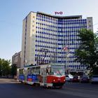
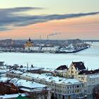
Nizhniy Novgorod sightseeing
Nizhny Novgorod was founded upon the order of Vladimir Duke Yuri Vsevodolovich in 1221. The city had long been an important defense point of the Russian land. Throughout its history, it was renamed twice. Its first name, Nizhny Novgorod, is still relevant. From 1932 to 1990, it was named Gorky after the Soviet writer Maxim Gorky. In 2000, Nizhny Novgorod became a capital of the Volga Federal District. In the … Open 
Travel guide to Nizhniy Novgorod
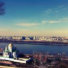
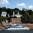
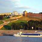
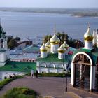
The main historical symbol of the city is the Nizhny Novgorod Kremlin. This impregnable fort was built in the 16th century. Originally, it was a large complex but only 13 towers and the 5-meter wall, which length is over 2km, have been preserved to this day. Beyond the fort, there are historical constructions built in different period. Today, most of the historical buildings are occupied by the representatives of … Open