

Printable maps of Chelyabinsk


Interactive maps of hiking and biking routes around Chelyabinsk
1. You can zoom in/out using your mouse wheel, as well as move the map of Chelyabinsk with your mouse.2. This interactive map presents two modes: 'Biking Routes' and 'Hiking Routes'. Use the '+' button on the map to switch between them.
Railway and landscape maps of Chelyabinsk area
This Chelyabinsk map has two modes: 'Railway Network' and 'Landscape & Rural Map'. Use the '+' button on the map to navigate.City tours, excursions and tickets in Chelyabinsk and surroundings
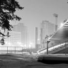
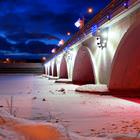
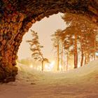
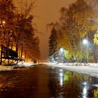
Photogallery of Chelyabinsk sights


Our guide to Chelyabinsk
Travel guide to Chelyabinsk
The oldest culture center in Chelyabinsk is the South Urals History Museum. It was opened in 1932. Now, the museum exposure includes over 250 000 exhibits, some of which are unique archaeological, historical, and ethnographic artifacts. One of the museum halls presents the natural-science collection. The other one stores pieces of applied art. The museum was “transferred” to its present building in 2006. It is … Open 
Chelyabinsk sightseeing
The laying of the railway caused the rapid development of the city. At the beginning of the 20th century, there were several industrial enterprises in the city territory. During the Great Patriotic War, Chelyabinsk gained its first unofficial name, Tankograd. Military equipment and ammunition were manufactured here. The contribution of the city to the Soviet army’s victory is invaluable. Today, outstanding … Open