

Interactive maps of hiking and biking routes around Paderborn
1. You can zoom in/out using your mouse wheel, as well as move the map of Paderborn with your mouse.2. This interactive map presents two modes: 'Biking Routes' and 'Hiking Routes'. Use the '+' button on the map to switch between them.
Railway and landscape maps of Paderborn area
This Paderborn map has two modes: 'Railway Network' and 'Landscape & Rural Map'. Use the '+' button on the map to navigate.City tours, excursions and tickets in Paderborn and surroundings
Germany - moving around the country
 The development of the country's transport system is associated with progress of international and domestic trade relations. To the date, Germany's transport interchange is recognized as one of the best in the world. Therefore, there is always the best option for any tourist. Railways are very popular. They are laid both inside the city and between regions. This is worth considering when buying a ticket. In mountainous regions of the country, there are specially equipped cog railways, so you can have a train even to the ski resorts. The rail transport features the high comfort and punctuality. There is a subway in 10 major cities. In Berlin, there is the largest and most extensive subway network, which embraces a dozen lines and more than 170 stations.
… Open
The development of the country's transport system is associated with progress of international and domestic trade relations. To the date, Germany's transport interchange is recognized as one of the best in the world. Therefore, there is always the best option for any tourist. Railways are very popular. They are laid both inside the city and between regions. This is worth considering when buying a ticket. In mountainous regions of the country, there are specially equipped cog railways, so you can have a train even to the ski resorts. The rail transport features the high comfort and punctuality. There is a subway in 10 major cities. In Berlin, there is the largest and most extensive subway network, which embraces a dozen lines and more than 170 stations.
… Open Nature and parks of Germany
Germany has an incredibly picturesque landscape; there are 14 national and 95 natural parks. In the north of the country, you can find ice. Dense forests prevail in the central part; the Alps are located in the south. Several large rivers - the Rhine, the Danube, the Elbe - are found here. There are numerous lakes too, the largest of which is the Bodensee. The largest national park, Schleswig-Holstein Watts, is located in the north of the country, on the coast of the Wattee Sea and occupies more than 400 thousand hectares. The park is in the UNESCO World Heritage List. Almost 2/3 of lands is regularly flooded during high tides or are permanently under water. There are about 10 million different birds, 2 000 species of insects; common porpoises, gray seals and horsehead seals live in the waters off the coast of the Wattee Sea. … OpenPhotogallery of Paderborn sights

Our guide to Paderborn
Paderborn sightseeing
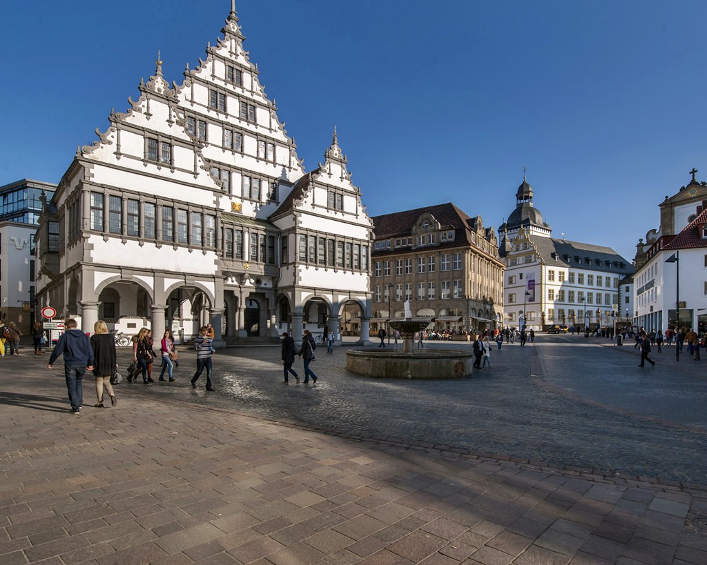
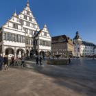
The City Council in Paderborn is another popular tourist destination. This is also an important architectural landmark. The construction of the City Council started in 1613 and lasted almost seven years. Perhaps, this is the most impressive example of the Weser Renaissance style in Germany. Prince Dietrich, who was the Bishop of Paderborn, ordered to build it. Before the City Council, there was an old … Open 