

Printable maps of Kaiserslautern

Interactive maps of hiking and biking routes around Kaiserslautern
1. You can zoom in/out using your mouse wheel, as well as move the map of Kaiserslautern with your mouse.2. This interactive map presents two modes: 'Biking Routes' and 'Hiking Routes'. Use the '+' button on the map to switch between them.
Railway and landscape maps of Kaiserslautern area
This Kaiserslautern map has two modes: 'Railway Network' and 'Landscape & Rural Map'. Use the '+' button on the map to navigate.City tours, excursions and tickets in Kaiserslautern and surroundings
Germany - moving around the country
 The territory of Germany has navigable routes; their length is about 7 000 km. The basins of the Rhine and the Danube are interconnected by the Main channel. Thanks to the river channels, it is easy to get from one region of the country to another and to cruise along major ports, while enjoying the delightful scenery. Boats regularly run along the canals. In Berlin, you can even use the services of a boat taxi that runs along the river Spree. The ferry can be reached from the port of Puttgarden to Warnemunde. An alternative for a traveler is to rent a bicycle. Since 2002, Germans actively began to develop cycling, so there are special lanes for two-wheeled vehicles even in small provinces. There are parking lots for bicycles; rental points are located practically in every district of any city.
… Open
The territory of Germany has navigable routes; their length is about 7 000 km. The basins of the Rhine and the Danube are interconnected by the Main channel. Thanks to the river channels, it is easy to get from one region of the country to another and to cruise along major ports, while enjoying the delightful scenery. Boats regularly run along the canals. In Berlin, you can even use the services of a boat taxi that runs along the river Spree. The ferry can be reached from the port of Puttgarden to Warnemunde. An alternative for a traveler is to rent a bicycle. Since 2002, Germans actively began to develop cycling, so there are special lanes for two-wheeled vehicles even in small provinces. There are parking lots for bicycles; rental points are located practically in every district of any city.
… Open Nature and parks of Germany
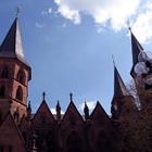
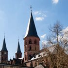
Germany has an incredibly picturesque landscape; there are 14 national and 95 natural parks. In the north of the country, you can find ice. Dense forests prevail in the central part; the Alps are located in the south. Several large rivers - the Rhine, the Danube, the Elbe - are found here. There are numerous lakes too, the largest of which is the Bodensee. The largest national park, Schleswig-Holstein Watts, is located in the north of the country, on the coast of the Wattee Sea and occupies more than 400 thousand hectares. The park is in the UNESCO World Heritage List. Almost 2/3 of lands is regularly flooded during high tides or are permanently under water. There are about 10 million different birds, 2 000 species of insects; common porpoises, gray seals and horsehead seals live in the waters off the coast of the Wattee Sea. … OpenPhotogallery of Kaiserslautern sights

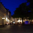
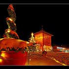
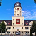
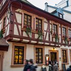
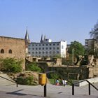
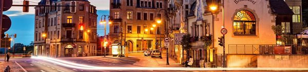
Our guide to Kaiserslautern
Attractions and active leisure
Gartenschau Park is an amazing place that can offer entertainments for any taste. Charming summerhouses, benches conveniently located in the shadow of trees, comfortable paved paths, athletic fields and playgrounds for children, and various decorations make this park a wonderful place for the whole family. Decorations in Gartenschau deserve a separate mention – dinosaurs of different types and sizes, butterflies, … Open 
Cuisine and top restaurants
Besides traditional cuisine, Kaiserslautern can offer more experimental menus. For example, Safari Restaurant is a unique dining venue that serves African food and drinks. Tourists particularly praise exotic drinks, such as incredibly delicious fruit beer and unique cocktails. The serving is no less eye-catching – all food is not only delicious but also looks fabulous and deserves to be photographed. The décor … Open
Traditions and mentality of Kaiserslautern
Perhaps, American soldiers who do military service at the base were the reason why Halloween has become such a popular holiday in Kaiserslautern. It is traditionally celebrated at the end of October. This is the time when numerous fair trades appear in the city, shops become filled with products for this holiday, and local people dress like monsters and witches. Parks and restaurants in Kaiserslautern host … Open
Travel guide to Kaiserslautern
For those who want to take a longer walk through the picturesque places, the Pfalzerwald Reserve is available. On its territory is the largest forest in Germany, the total area of the reserve is about 180,000 hectares. On the territory of the park there are many routes, here travelers can admire the beautiful lakes and rivers, and also see rare species of trees and plants. There are many wild inhabitants in … Open
Kaiserslautern for children - what to visit
Volkspark is also an interesting and attractive place. One of its main decorations is a lake in which very nice ducks live and children will definitely like to feed them. The park is perfect for hiking and cycling. Many interesting sculptures and landscapes can be found on its territory. There are also spacious glades in the park where one can play active games or have a picnic. In the warm season, there are many … Open
Shopping, streets and outlets
Marco's Moden is an original shop that sells female clothes and shoes of plus sizes. This is the right place for ladies who want to look trendy and elegant, but sometimes have trouble finding the right size. Despite the popularity, the prices are always very attractive. Attractive denim pants usually cost less than 20 euro, and a gorgeous summer dress can easily cost 15 euro. Peek & Cloppenburg remains one of … Open