

Interactive maps of hiking and biking routes around Maceio
1. You can zoom in/out using your mouse wheel, as well as move the map of Maceio with your mouse.2. This interactive map presents two modes: 'Biking Routes' and 'Hiking Routes'. Use the '+' button on the map to switch between them.
Railway and landscape maps of Maceio area
This Maceio map has two modes: 'Railway Network' and 'Landscape & Rural Map'. Use the '+' button on the map to navigate.City tours, excursions and tickets in Maceio and surroundings
Nature and parks of Brazil
Brazilians are very serious about protecting the natural environment. Protected areas are zones of animate and inanimate nature, which need protection from pollution and extinction. For example, this is the Campos de Manicoré in the state of Amazonas stretching for about 152 thousand hectares. In Rio de Janeiro, there is the Jaceruba Environmental Protection Area. Until recently, here it was allowed to hunt and catch wild animals for sale as exotic pets, and restaurants served their meat. In 2002, this was brought to an end, and today the zone is under strict government control. The Ilha Comprida Environmental Protection Area preserves sand dunes, dense forests, more than 70 kilometers of clean beaches and mangroves. It is home to terrestrial and marine South-Atlantic animals, more than 30 species of migratory birds arrive here every year. … OpenPhotogallery of Maceio sights
Our guide to Maceio
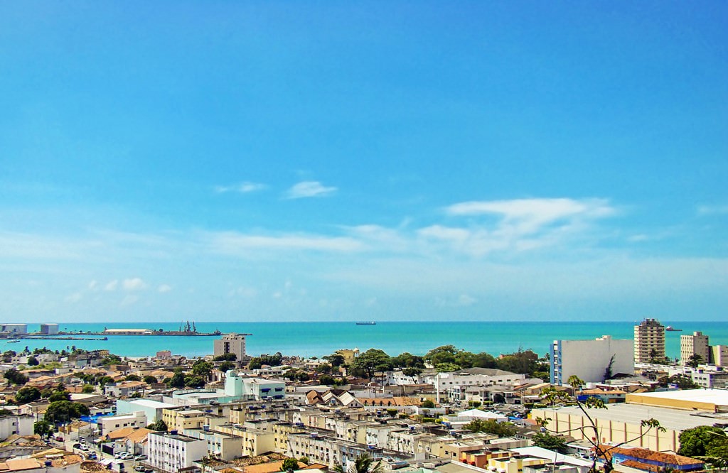
Maceio sightseeing
Unfortunately, not many countries in the world have a direct air connection to Maceio. When flying to Brazil, many tourists prefer to make a change at a large European airport, for example, in London or Zurich. Maceio has an international airport that serves flights from different European countries. It is also possible to fly to a large Brazilian city such as Rio de Janeiro or Sao Paolo first. After that, take a … Open 