


Sightseeing in Rochefort - what to see. Complete travel guide
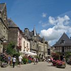
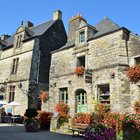
 Rochefort is a popular tourist destination in the Belgian province of Namur. This municipality is a magnet for all tourists who enjoy exploring new places on foot. Rochefort is still rich in medieval architectural landmarks that are well maintained and are in good condition. A walk in Rochefort promises to be interesting. The ruins of the old castle are particularly popular with guests of the Belgian town. Picturesque local nature and old buildings bring travelers back to the past and reveal the history and traditions of the region. Many buildings in Rochefort were built in the Middle Ages and they peacefully coexist with modern dwellings.
The name of this Belgian town can be translated as “the solid rock”. Historic documents of the past centuries prove that Rochefort got its name not randomly. Initially, there was a fortress on the site of the modern town. The fortress was built along the road connecting Liege and Bouillon. Later, the fortress was destroyed. The Löwenstein dynasty became the rulers of Rochefort at the beginning of the 17th century. Under the guidance of the new leaders, the town became a part of France in 1795. Rochefort returned to Belgium only thirty-five years later.
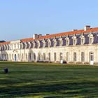
However, the coming centuries were bringing more challenges to locals. The population of Rochefort was suffering from hunger, epidemics, and numerous enemy attacks. Monks decided to start a major restoration of their abbey in 1664. All works were finished only in the middle of the 18th century. As the monastery changed several owners, this caused a devastating effect on its condition. Only when monks from the Limburg Monastery arrived in Rochefort, it became possible to restore the former importance of the monastery. The first beer brewery opened here in 1899.
 Would you like to visit a real cave? One of the most visited attractions in Belgium – the Caves of Han-sur-Lesse – is located not far from Rochefort. Every year, millions of tourists visit the gorgeous natural attraction to see the miraculously beautiful caves. The cave appeared in the result of the underground erosion in a limestone hill and the activity of the river Lesse. It is particularly pleasant to take a walk here in summer because the temperature of the air in the cave is rarely above 13°C. The air inside the cave is very humid, so think of the proper clothes beforehand.
To get to the Caves of Han-sur-Lesse, tourists need to get on a special tramway. There is a retro tram that takes passengers to interesting excursions in the Namur Province. The total length of the excursion is roughly one and a half to two hours. During a visit to the caves, tourists can see an interesting light show that takes place in the main cave hall. Moreover, visitors are welcome to take a boat ride on the underwater river. Just like many similar caves, the Caves of Han-sur-Lesse have unique acoustic properties. To prove this, there are regular sound shows in the caves, during which visitors can see and listen to fires of the real cannons.
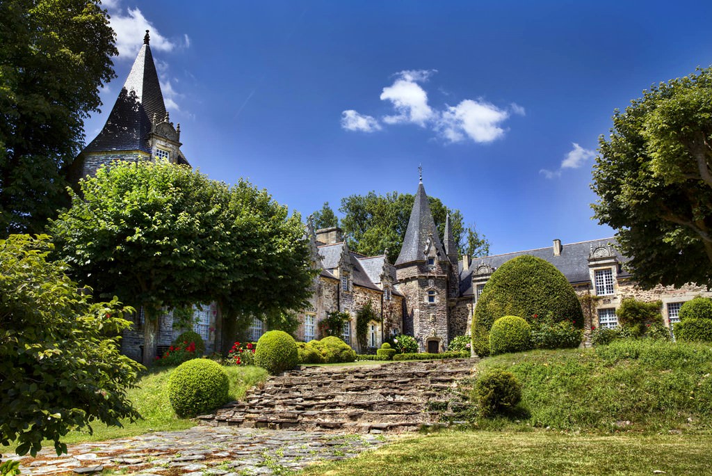
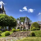
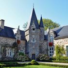
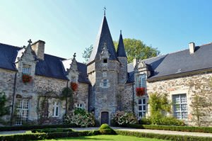
 A fortress with a tower was built in Rochefort suburbs in the 13th century. Soon after that, the fortress was transformed into the Castle of Lavaux-Saint-Anne. The building has a diamond shape with the 14th-century towers at the edges. A large moat filled with water surrounds the fabulous castle. The central four-story tower still has the loophole galleries. In the basement, there is a warehouse for food and water. The arched halls of the castle amaze with their acoustic properties. Only three people talking are enough to produce a sound similar to a bustling crowd.
It is not possible to get directly to Rochefort from most countries of the world. Moreover, there are no direct trains to Rochefort from other Belgian cities. The bus from Brussels to Luxembourg is still the only way to get to this Belgian town. The buses depart from the Jemelle Station in Brussels. There is also a bus from Namur to Rochefort. The journey time is roughly forty minutes in this case.
This guide to iconic landmarks and sights of Rochefort is protected by the copyright law. You can re-publish this content with mandatory attribution: direct and active hyperlink to www.orangesmile.com.
City tours, excursions and tickets in Rochefort and surroundings
Reference information
Map of all castles
Survived castles around Rochefort
♥ Castle 'Jemeppe Castle' , 7.1 km from the center. On the map
♥ Castle 'Château de Lavaux-Sainte-Anne' , 10.4 km from the center. On the map
♥ Castle 'Jannée Castle' , 13.2 km from the center. On the map
♥ Castle 'Château Miranda' , 17.9 km from the center. On the map
♥ Castle 'Château de Vêves' , 18.4 km from the center. On the map
Map of all parks
National and city parks around Rochefort
♥ Regional Nature Park 'Ardennes' , 55.1 km from the center. On the map
♥ National Park 'De Meinweg' , 126.4 km from the center. On the map
♥ National Park 'De Groote Peel' , 135.9 km from the center. On the map
♥ National Park 'Grenspark de Zoom - Kalmthoutse Heide' , 149.4 km from the center. On the map
♥ Regional Nature Park 'Lorraine' , 153.3 km from the center. On the map
Sights around Rochefort from our guide 'Extreme places on Earth'
Baumwipfelpfad Schwarzwald
From the series “Elegant Architectural Structures for Fans of Skywalks”
Check on the map:  Distance from Rochefort center - 64.3 km.
It is noteworthy that Baumwipfelpfad tower does not harm the unique nature reserve, and also helps to keep its pristine beauty. Tourists move on the ground covered with wooden bridges and don’t trample the soil, otherwise considerable damage to the park would be caused because of the huge number of visitors. The dome tower has an amazing secret. Three huge fir trees grow right inside of it. Visitors can see the composition in all its glory while climbing up. …
Read further Montagne de Bueren
From the series “Furious Footways Around the World That Make You Dizzy”
Check on the map: Distance from Rochefort center - 59.9 km.
Guests of Liege, who are not lazy to walk to the end of the stairs, will have an opportunity to admire not only unique historical sights. From the historic district, a wonderful panoramic view of the Maas river opens. Walking on the stairs will be comfortable and pleasant even for those who do not like long walks. On the stairs in certain places beautiful shops were established, where you can always relax. There is a cult place of interest in Liege with the official name "Buren Mount", it was named after the nobleman Vincent de Buren, who played an important role in the defense of the city. …
Read further 