

 English
 Russian
 Dutch
Dutch German
 Spanish
 French
 Türkçe
Detailed hi-res maps of Plovdiv for download or print

City tours, excursions and tickets in Plovdiv and surroundings
Moving around in Bulgaria - transportation
 In recent years, Bulgaria has been experiencing more and more influx of tourists. This has caused the State to constantly renovate the transport infrastructure. Today, almost all types of public transport have been developed in the country, although the quality of transport services does not always correspond to European standards. The most popular type of public transport in the country is buses (less often, trolleybuses and trams). It is worth noting that public urban transport in large cities, especially at the height of the tourist season, is often insufficient. As a result, trolleybuses and trams, as well as buses, run overcrowded. Also, the technical condition of the motor transport leaves much to be desired.
… Open
In recent years, Bulgaria has been experiencing more and more influx of tourists. This has caused the State to constantly renovate the transport infrastructure. Today, almost all types of public transport have been developed in the country, although the quality of transport services does not always correspond to European standards. The most popular type of public transport in the country is buses (less often, trolleybuses and trams). It is worth noting that public urban transport in large cities, especially at the height of the tourist season, is often insufficient. As a result, trolleybuses and trams, as well as buses, run overcrowded. Also, the technical condition of the motor transport leaves much to be desired.
… Open Economy roadmap of Bulgaria
Bulgaria is a sufficiently developed country in comparison with other countries. However, so far its economic condition does not allow it a leading position among the countries of the European Union. Back in the 90s, the country experienced several serious economic crises. However, to date, there has been a fairly large stable economic growth, at least 5% in one year. Bulgaria has a fairly economically advantageous territorial location; as it lies in close proximity to one of the most important maritime transport highways. Thus, Bulgaria was able to establish reliable trade relations not only with the members of the Euro zone, but also with Asian and African countries. If we talk about natural resources, the territory of Bulgaria cannot be termed rich in natural resources. There are small reserves of iron and copper ore, as well as manganese, and coal. … Open
Car rental on OrangeSmile.com

Hilton builds third luxury hotel in Kyoto
The Hilton Kyoto hotel will be attractive to a wide range of guests. Leisure travelers will appreciate the close proximity to famous attractions such as Heian and Yasaka Temples, the Kyoto Imperial Palace, and the scenic Gion Historical District. In a few minutes, guests can reach the metro stations, the path to the sights of interest will not take much time. Read this
27.04.2024
The Hilton Kyoto hotel will be attractive to a wide range of guests. Leisure travelers will appreciate the close proximity to famous attractions such as Heian and Yasaka Temples, the Kyoto Imperial Palace, and the scenic Gion Historical District. In a few minutes, guests can reach the metro stations, the path to the sights of interest will not take much time.
27.04.2024
Search for services, infrastructure and sights on map of Plovdiv
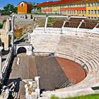
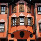
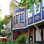
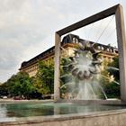
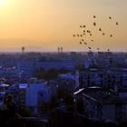
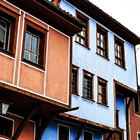
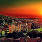
Photogallery of Plovdiv sightseeing


Our guide chapters over Plovdiv
Top hotels with reviews
Hotel Romantica is open in the very heart of the city, in one of the most beautiful buildings in whole Plovdiv. This is the place where travelers will find colorful guest rooms in sunny shades that offer a striking view of the Roman stadium and other outstanding landmarks of the central region. The design of the hotel is simple and attractive at the same time. All guest rooms feature charming paintings of the … Open 
Attractions and active leisure
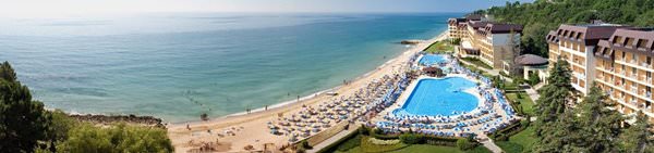
There is a large variety of entertainment in Plovdiv. If you come to the city in the hot summer, be sure to visit Aqualand Water Park. You can swim and relax in Aqualand, as well as get a perfectly even tan in a non-coastal city. The administration's policy regarding sunbeds contributes to this – you get the opportunity to sunbathe all day long for a small amount of money. There is an Olympic swimming pool … Open
Cuisine and top restaurants
You can find places with dishes of Bulgarian, Turkish, Greek, Russian, Serbian and other cuisines of neighboring countries in Plovdiv. Many migrants live here. They are ready to introduce you to their culinary traditions. So you will not stay hungry for sure. Although it is worth noting that the Bulgarian cuisine will appeal to many tourists largely due to the amazing variety of dishes. Local chefs use a variety of … Open
Traditions and mentality of Plovdiv
Many events take place in Plovdiv. For example, the Specialized Exhibition of Flowers, Ornamental Plants, Garden Equipment and Supplies takes place here in March. Everyone who is fond of gardening, floristry or just interested in beautiful flowers should visit the exhibition. The International Exhibition on Municipal Services, Urban Development & Public Works, which is a more specialized event, takes place at the … Open
Travel guide to Plovdiv
Acquaintance with the national cuisine is a great way to make your vacation in Plovdiv even more exciting. At the resort, there are many restaurants that specialize in Bulgarian cuisine. Meat dishes and dairy products make up the basis of the national cuisine. Only here vacationers can try an unusual soup that has fermented milk as its main ingredient. Fans of hearty meat dishes will be pleased with the choice of … Open
Plovdiv for children - what to visit
Plovdiv is a fairly large city by the standards of Bulgaria. There are several places where it will be interesting for both adults and children. Although there are not many attractions in the city, entertainment for children can be found in local shopping centers. Usually, these are simple things like a shooting range, a small skating rink or a couple of slot machines designed more for kids than teenagers. However, … Open