

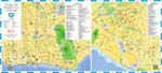
Additional maps of Ecuador
Unique points of interest in Ecuador
San Rafael Falls
From the series “Most Fanciful Waterfalls of the Planet” San Rafael is one of the most beautiful waterfalls in Ecuador. It is a demonstration of the incredible power of nature and has a height of 150 meters. The waterfall is located in a special natural area, at the foot of the active Reventador volcano. At the moment, the highest waterfall in Ecuador is located on the territory of Sumako Nature Reserve, whose distinctive features include incredible lush tropical vegetation.
As a rule, all excursions to the reserve start from the city of Quito. Their duration is quite high. The San Rafael waterfall is almost 200 km from Quito. To see the wonderful natural attraction, you need to drive through the most complex mountain streamer. On the way, tourists will meet several settlements, where they can stay for a rest, get acquainted with the life and … Read all
Rocas Bainbridge
From the series “Majestic and Spectacular Craters and Crater Lakes”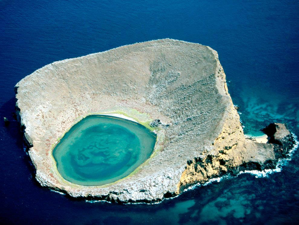 Galapagos Islands are rich in unique natural sights. Not far from Santiago Island is the strange crater Rocas Bainbridge. This is an incredibly beautiful tiny funnel island that is bathed from all sides by the sea. In the center of the island is the fabulous blue lake.
 The crater lake is salty. Its fantastic color is due to the high mineral concentration. Although the island seems quite lifeless, you can still find some vegetation on it. In the salt lake grow the rare species of the water plants, the graceful flamingos here approaching.
The tourists can graze on the wonderful crater during a boat trip. On the coast of Santiago Island the exciting excursions are organized and the boats and boats are lent. Travelers who want to take the impressive photos of Rocas Bainbridge Crater can … Read all
Fantastic City Tours and Excursions in Ecuador
Country maps

Interactive maps of hiking and biking routes in Ecuador
1. You can zoom in/out using your mouse wheel, as well as move the map of Ecuador with your mouse.2. This interactive map presents two modes: 'Biking Routes' and 'Hiking Routes'. Use the '+' button on the map to switch between them.
Railway and landscape maps of Ecuador
This Ecuador map has two modes: 'Railway Network' and 'Landscape & Rural Map'. Use the '+' button on the map to navigate.Maps of cities and regions of Ecuador

Manta
Manta is widely recognized as one of the main ports in Ecuador. Moreover, this is a major tourist center and a popular destination in the country. Manta is situated in Manabi Province. Tourists from all parts of the world arrive here to enjoy a mesmerizing vacation on the ocean coast and visit fabulous local beaches. Furthermore, each vacationer is free to choose the most suitable place for sunbathing and beach recreation because there are comfortable beaches at the ocean coast and no less … Read more 
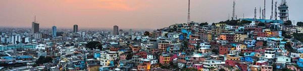
Guayaquil
Among obligatory touristic sites of the city, the St. Peter's Cathedral should be noted. The very first church on this place was constructed in the period of the early Middle Ages. For years of existence, it seriously collapsed more than once from fire and has also been repeatedly damaged during attacks of pirates. In 1695, the church was moved to a new place, where it has constantly remained since then. In 1948, the last major reconstruction of the cathedral took place during which it was tried … Read more

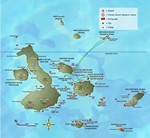
Galapagos
Unique natural landmarks remain the main treasure of the archipelago. At the moment, as much as 90% of the islands’ territory is occupied by the national park. It is a fabulous place to watch albatrosses and rare sea turtles. Among visitors of the islands, there are many not only curious travelers but also scientists. Currently, there are more than 60 different trails in the national park. However, tourists need to remember that they are allowed to explore it only together with a guide. … Read more