

Maps of cities and regions of Suriname

Country maps

Interactive maps of hiking and biking routes in Suriname
1. You can zoom in/out using your mouse wheel, as well as move the map of Suriname with your mouse.2. This interactive map presents two modes: 'Biking Routes' and 'Hiking Routes'. Use the '+' button on the map to switch between them.
Railway and landscape maps of Suriname
This Suriname map has two modes: 'Railway Network' and 'Landscape & Rural Map'. Use the '+' button on the map to navigate.Maps of cities and regions of Suriname

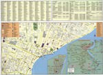
Paramaribo
In the vicinity of the city, there is another ancient stronghold - Fort Nieuw-Amsterdam. Its construction lasted 13 years and was fully completed in 1747. The impregnable fortress was erected to protect the Dutch colonies. The old fortress played an important role during the Second World War - a large artillery point was equipped here by the American army. After the war, huge cannons were preserved in the fortress, which can be seen here today. One of the most visited cultural facilities in … Read more 