
Sightseeing in Sarajevo - what to see. Complete travel guide
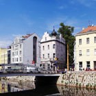
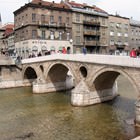
 Sarajevo is a unique city, which has managed to preserve its "oriental" style and appearance even in the post-war time. The city is dotted with many narrow streets. You will easily find here numerous mosques and the picturesque old Turkish bazaar.
Ethnic cuisine is genuinely unique and presents a balanced fusion of culinary traditions of Slavic, Mediterranean, Turkish and German cuisines. In the heart of the menu of numerous …  Open
Open
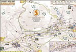
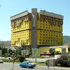
The first settlement in the modern Sarajevo area was established as far back as in 1263. The city of Sarajevo is rich in historical and architectural monuments, landmarks and sites belonging … Open
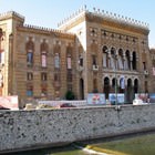
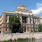
 One of the magnificent old palaces houses the Historical Museum of Bosnia and Herzegovina, founded in 1945. The museum exposition includes over 300000 unique pieces concerning the most diverse aspects of the country's history and culture. Visitors can enjoy collections of old books, works of art, photographs and documents, as well as exhibits dedicated to wartime difficult for the country.
The city of Sarajevo is known for plenty of attractive shops, boutiques and markets. The city offers its guests excellent parks for hiking and tranquil relaxation as well as sport centers … Open
 Those tourists who are partial to modern history, must necessarily visit the Sarajevo military tunnel. It was built during the Bosnian War and in 1992 - 1995 served as a shelter for local residents. Over the war years, the tunnel was partially destroyed. Only 20 meters of an underground passage left. Here, the local Kolar family opened a military museum, which contains really interesting pieces.
1. An optimum season to plan a visit to Sarajevo is considered to be a period from May to September as during these months the weather is the most favorable for city exploration and … Open
This guide to iconic landmarks and sights of Sarajevo is protected by the copyright law. You can re-publish this content with mandatory attribution: direct and active hyperlink to www.orangesmile.com.
City tours, excursions and tickets in Sarajevo and surroundings
Reference information
Map of all shopping areas

Shopping streets in Sarajevo
♥ Shopping area ' Titova' Sarajevo, 2.6 km from the center. On the map
♥ Shopping area ' Ferhadija and Sarači' Sarajevo, 3.7 km from the center. On the map
Map of all castles
Survived castles around Sarajevo
♥ Castle 'Bijela Tabija' Sarajevo, 5 km from the center. On the map
♥ Castle 'Old town of Visoki' Visoko, 21.8 km from the center. On the map
♥ Castle 'Bobovac' VarešKraljeva Sutjeska, 34.1 km from the center. On the map
♥ Castle 'Samobor Castle' Hladila, 60.9 km from the center. On the map
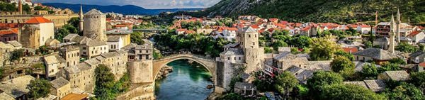
♥ Castle 'Blagaj' Mostar, 76.9 km from the center. On the map
Map of all parks
National and city parks around Sarajevo
♥ National Park 'Sutjeska' , 61.4 km from the center. On the map
♥ World Heritage Site 'Durmitor National Park' , 97.8 km from the center. On the map
♥ Forest Park 'Velika i Mala petka' , 135.7 km from the center. On the map
♥ National Park 'Mljet' , 143.3 km from the center. On the map
♥ National Park 'Biogradska Gora' , 147.2 km from the center. On the map
Sights around Sarajevo from our guide 'Extreme places on Earth'
Lukomir Village
From the series “The Most Cozy Towns Full of Zen”
Check on the map:  Distance from Sarajevo center - 28.8 km.
As many hundreds of years ago, indigenous people sew clothes by themselves. Locals wear beautiful national costumes and conduct a number of amazing national rituals. Travelers who want to visit this special village, which is lost in the mountains, have to consider that they can reach it by foot only. Guided tours for tourists are held only during warmer months. With the onset of winter cold it becomes very dangerous to go mountain hiking. …
Read further Bosnian Pyramid
From the series “Top Survived Pyramids from Previous Civilizations”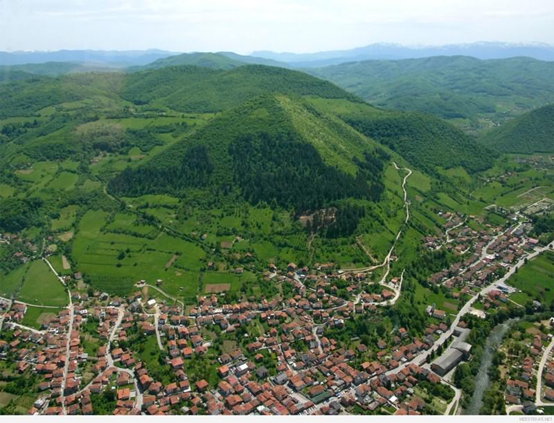
Check on the map: Distance from Sarajevo center - 23.2 km.
In 2006, the great archaeological research began under his direction. After the excavations the Bosnian pyramids were graded. The researchers claimed that they were discovering the secret tunnel and the entrances into the pyramid during the excavations. However, there is no documented proof of their scientific achievements. The incredible theory of Semir Osmanagitsch is confirmed by the fact that the sides of the pyramid hill are exactly aligned to the directions of the heavens, which makes it similar to the legendary Egyptian pyramids and the pyramids of Maya. …
Read further Sightseeing in Bosnia And Herzegovina: things to see
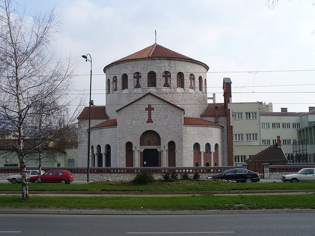
 Bosnia and Herzegovina is a very old country with rich history and heritage. Many cultures have shaped the country, and every epoch has left its mark. Sarajevo is one of the oldest cities of the country. This is the capital and the largest cultural centre of Bosnia and Herzegovina. Travellers are traditionally interested in visiting the eastern part of the city as there are many architecture landmarks there. The main sights include Sacred Heart Cathedral, City Hall, Saint Josef’s Church, Old Synagogue and Old Orthodox Church. One interesting fact about Sarajevo – Christian churches border with Islamic mosques on the streets of the city.
… Open
Bosnia and Herzegovina is a very old country with rich history and heritage. Many cultures have shaped the country, and every epoch has left its mark. Sarajevo is one of the oldest cities of the country. This is the capital and the largest cultural centre of Bosnia and Herzegovina. Travellers are traditionally interested in visiting the eastern part of the city as there are many architecture landmarks there. The main sights include Sacred Heart Cathedral, City Hall, Saint Josef’s Church, Old Synagogue and Old Orthodox Church. One interesting fact about Sarajevo – Christian churches border with Islamic mosques on the streets of the city.
… Open