

Interactive maps of hiking and biking routes around Mgarr
1. You can zoom in/out using your mouse wheel, as well as move the map of Mgarr with your mouse.2. This interactive map presents two modes: 'Biking Routes' and 'Hiking Routes'. Use the '+' button on the map to switch between them.
Railway and landscape maps of Mgarr area
This Mgarr map has two modes: 'Railway Network' and 'Landscape & Rural Map'. Use the '+' button on the map to navigate.City tours, excursions and tickets in Mgarr and surroundings
Malta - moving around the country
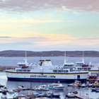
 In general, tourists in Malta do not encounter any difficulties with regards to transportation. The most popular type of public transportation are buses. They (buses) usually run frequently and practically all trips connect certain regions with the capital of the republic. There are buses from 5.30 to 23.00. Over-night trips operate only from Friday to Monday and with long interval. Tickets are usually purchased directly from the driver. The bus services work worse in areas which are far from tourist centers; the transport can run only two or three times a day. An alternative to it, in this case, are horse-drawn carriages. This is not the most comfortable form of transport, but it is however much cheaper.
… Open
In general, tourists in Malta do not encounter any difficulties with regards to transportation. The most popular type of public transportation are buses. They (buses) usually run frequently and practically all trips connect certain regions with the capital of the republic. There are buses from 5.30 to 23.00. Over-night trips operate only from Friday to Monday and with long interval. Tickets are usually purchased directly from the driver. The bus services work worse in areas which are far from tourist centers; the transport can run only two or three times a day. An alternative to it, in this case, are horse-drawn carriages. This is not the most comfortable form of transport, but it is however much cheaper.
… Open Nature and parks of Malta
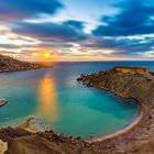
The rest of the islands are archipelago or sparsely populated (Comino), or are uninhabited. Uninhabited islands are a protected by government. One of the most picturesque islands of the archipelago is the Cominotto, located near the island of Comino. Between the islands, there is a lagoon with water of bright, azure color, which became one of the symbols of the country and its beach rest. Another important island is Fylla, which is a rock with a height of 60 meters and a flat top. The territory of the island is for nature conservation. On the rocks, nest rare and endangered species of birds, among them the Mediterranean petrel and the straight-tailed petrel. Also on the island are endemic species of lizards and snails. The area around the island is also a reserve; fishing in this area is prohibited. … OpenPhotogallery of Mgarr sights

Our guide to Mgarr
Mgarr sightseeing
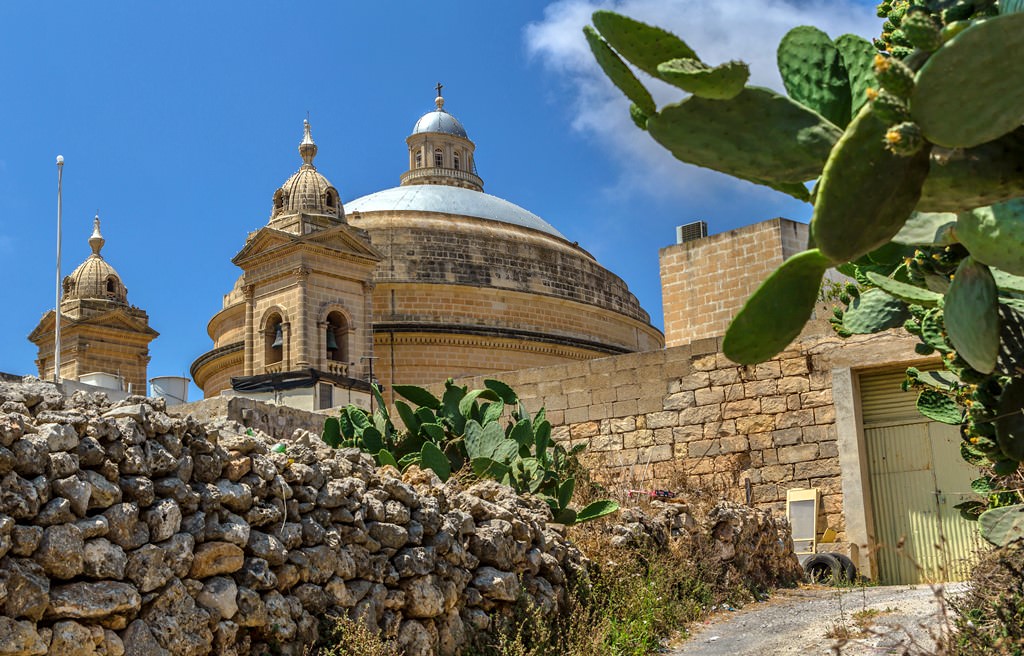
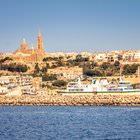
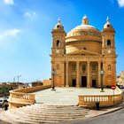
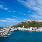
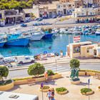
The history of the settlement with an unusual name – Mgarr – started in the middle of the 13th century. Initially, this was a village, residents of which were mostly engaged in fishing. First inhabitants in Malta appeared on the island much earlier – long before our age. During the Neolithic period, ancient people were building megalithic temples in Malta, and many of them have survived until the present day. … Open 