

Maps of cities and regions of Lebanon
Additional maps of Lebanon
Unique points of interest in Lebanon
The Temple of Jupiter
From the series “The Most Mysterious Constructions of the Planet”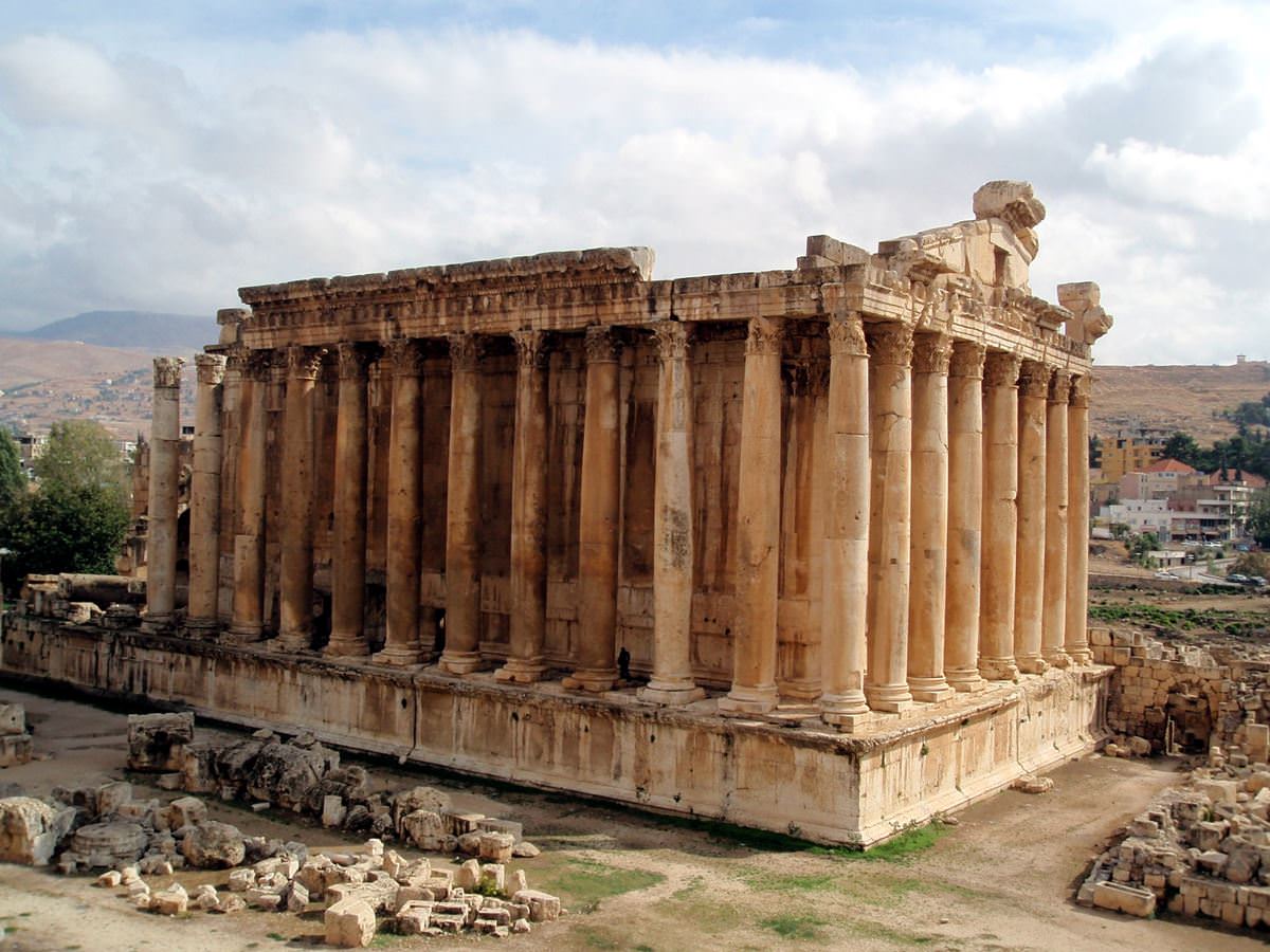 A unique building is the ancient Jupiter temple, located in the old Lebanese city of Baalbek. Although the ancient building is now in ruins, it still admires with the size and constructional features. The main secret of the temple is the huge plates at its base, as well as the carved marble columns, whose height reached 20 meters after the approximate bills.
 How many thousands of thousands of such buildings could be erected, remains unclear until today's point of view. According to the historical data, the temple in Baalbek has existed for centuries and was partly destroyed by the Emperor's Theodosius government. This area was believed to be sacred and extremely important a thousand years ago. This could explain the emergence of the gigantic temple.
In the attempt to imagine the … Read all
Three Bridge Chasm
From the series “Largest and Most Branched Caves on Earth”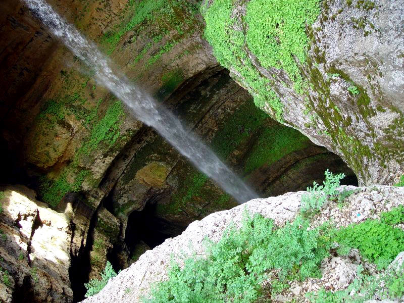 The abyss three bridges - such a name has the Jura cave, which is located in Lebanon. Its natural entrance is an abyss in the earth's crust with the depth of 225 meters, into which flows the Baatara waterfall. These wonderful sites of natural origin are considered as the unity. The cave-name perfectly reflects one of its chief features. In the abyss you can see three natural bridges, one above the other. According to the approximate calculations, the cave has been formed more than 160 million years ago. The impetuous underground rivers and streams continue to form the labyrinth further today.
 Only the experienced speleologists can descend to the cave-grounds. At the disposal of the tourists is another exciting event - walk on one of the bridges and visit the beautiful waterfall. The … Read all
Country maps

Interactive maps of hiking and biking routes in Lebanon
1. You can zoom in/out using your mouse wheel, as well as move the map of Lebanon with your mouse.2. This interactive map presents two modes: 'Biking Routes' and 'Hiking Routes'. Use the '+' button on the map to switch between them.
Railway and landscape maps of Lebanon
This Lebanon map has two modes: 'Railway Network' and 'Landscape & Rural Map'. Use the '+' button on the map to navigate.Maps of cities and regions of Lebanon

Beirut
In Beirut, there is a very interesting Serail clock tower, it is not far from the Grand Palace. The clock on the site was established in 1897 on the 10th anniversary of the Sultan Abdul-Hamid II’s coronation. Later, this architectural monument was neglected, until in 1994 it was fully restored. For the construction of a new tower the highest quality materials were used, including locally produced sandstone and rare species of basalt. The height of the clock tower now stands at 25 meters, … Read more 

Byblos-Jbeil
Byblos-Jbeil or simply Byblos is the largest city in the Mount Lebanon Governorate. It is located forty kilometers from the country’s capital. This is an interesting place that attracts tourists by its unusual atmosphere. When you enter Byblos, it feels like you just made time travel – the city is very old and still has many ancient ruins. Besides this, Byblos is situated on the coast of the Mediterranean Sea, so local beaches are perfectly suitable for swimming and sunbathing. When the … Read more