

Interactive maps of hiking and biking routes around Halmstad
1. You can zoom in/out using your mouse wheel, as well as move the map of Halmstad with your mouse.2. This interactive map presents two modes: 'Biking Routes' and 'Hiking Routes'. Use the '+' button on the map to switch between them.
Railway and landscape maps of Halmstad area
This Halmstad map has two modes: 'Railway Network' and 'Landscape & Rural Map'. Use the '+' button on the map to navigate.City tours, excursions and tickets in Halmstad and surroundings
Sweden - moving around the country
 Sweden is an economically developed country. This is why its transport infrastructure is at a fairly high level. The air transportation network is particularly widespread. In modern times, there are more than one hundred and fifty airports within the territory of Sweden for various purposes, most of which are oriented towards working with international airlines. The biggest airport in Sweden by status and size is Arlanda. This airport has gained the status of the main airport of the country. 35 years ago, the airport accepted only flights from other countries. However, its territory was expanded over time, thanks to which, it became possible to receive domestic flights too. The airport is located less than 40 kilometers from the Swedish capital. Within the territory of this airport, you will find all necessities for the comfortable rest of passengers awaiting their flights. The capacity of this airport exceeds one million people per year.
… Open
Sweden is an economically developed country. This is why its transport infrastructure is at a fairly high level. The air transportation network is particularly widespread. In modern times, there are more than one hundred and fifty airports within the territory of Sweden for various purposes, most of which are oriented towards working with international airlines. The biggest airport in Sweden by status and size is Arlanda. This airport has gained the status of the main airport of the country. 35 years ago, the airport accepted only flights from other countries. However, its territory was expanded over time, thanks to which, it became possible to receive domestic flights too. The airport is located less than 40 kilometers from the Swedish capital. Within the territory of this airport, you will find all necessities for the comfortable rest of passengers awaiting their flights. The capacity of this airport exceeds one million people per year.
… Open Nature and parks of Sweden
Another popular tourist destination is the Sarek National Park, located in the Jokkmokk region. Despite the fact that it does not have any laid-out tourist route, every year a huge number of people come here to conquer mountain peaks or go hiking. Climbers are attracted by the mountain Sarektjakka, whose peak is the second highest in the country (about 2000 meters). Climbing is incredibly difficult. The route is not always conquered even by professionals. The park is one of the oldest and largest in the country. On its lands there are more than 100 ancient glaciers. The park's territory is included in the World Heritage List, as the park is part of the Swedish Lapland. … OpenPhotogallery of Halmstad sights

Our guide to Halmstad
Halmstad sightseeing
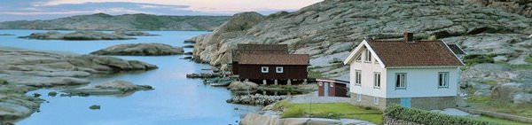
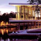
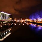
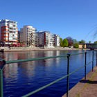
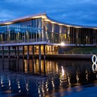
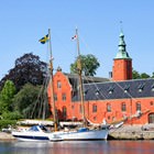
A major seaport and a famous industrial center, this place has been one of the biggest defensive spots of Sweden. The city was founded in the 11th century and until the 16th century it was used as a military base. The coat of arms of the city depicts three hearts, which symbolize courage and heroism of the local people. Halmstad is situated on the bank of the Nissan River. These scenic spots and rich historical … Open 
Travel guide to Halmstad
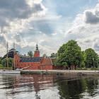
The most beautiful historical street in the city is Storgatan. The walks along it will turn into an incredibly exciting tour. Here, you can see buildings, the age of which is several hundred years. In the historical street, the old wall fragment has been preserved. Today, on the ground floors of old buildings, there are popular stores, cafes and restaurants. The Norre Katts Park is very popular with nature … Open