

Interactive maps of hiking and biking routes around Gyumri
1. You can zoom in/out using your mouse wheel, as well as move the map of Gyumri with your mouse.2. This interactive map presents two modes: 'Biking Routes' and 'Hiking Routes'. Use the '+' button on the map to switch between them.
Railway and landscape maps of Gyumri area
This Gyumri map has two modes: 'Railway Network' and 'Landscape & Rural Map'. Use the '+' button on the map to navigate.City tours, excursions and tickets in Gyumri and surroundings
Armenia - moving around the country
 There is even a trolleybus line in the capital of Armenia and recently the country bought several new trolleybuses. However, the condition of the others leaves much to be desired. Also, tourists can use the services of the subway in Yerevan. Practically every tourist city has taxis. If however you are trying to save money, then it is not worth catching a car on the road, because the prices in his case will be exorbitantly high. If there is no other way out, then you should immediately negotiate the price with the driver. It is best to just call for a taxi by phone. The cost of one kilometer ride is about 100 drams and the minimum trip is not less than 650 drams. The cost of the trip should be checked with the dispatchers during the taxi call. The peculiarities of the interchange in the country are the cable cars. Their development of course is affected by the specific mountainous terrain. In some cases, traveling by cable car can cut down the time of travel by other means of transportation by at least four hours. Also do not forget that there are no traffic jams on the cable cars, and the cost of crossing is relatively cheap.
… Open
There is even a trolleybus line in the capital of Armenia and recently the country bought several new trolleybuses. However, the condition of the others leaves much to be desired. Also, tourists can use the services of the subway in Yerevan. Practically every tourist city has taxis. If however you are trying to save money, then it is not worth catching a car on the road, because the prices in his case will be exorbitantly high. If there is no other way out, then you should immediately negotiate the price with the driver. It is best to just call for a taxi by phone. The cost of one kilometer ride is about 100 drams and the minimum trip is not less than 650 drams. The cost of the trip should be checked with the dispatchers during the taxi call. The peculiarities of the interchange in the country are the cable cars. Their development of course is affected by the specific mountainous terrain. In some cases, traveling by cable car can cut down the time of travel by other means of transportation by at least four hours. Also do not forget that there are no traffic jams on the cable cars, and the cost of crossing is relatively cheap.
… Open Nature and parks of Armenia
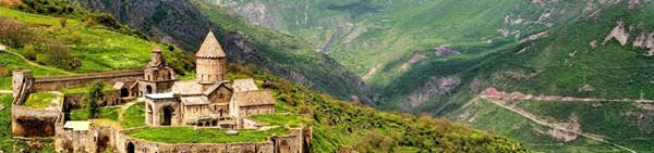
There are also several reserves in Armenia, where a person can only carry out research and observations. The Khosrov Reserve is in the western part of the country, close to the border with Turkey. It features delightful views of the hills covered with unique plants and trees. About 146 species of local plants are in the Red Book. The red cherry, mountain ash, hawthorn, Vavilov rye, and almonds are among them. The fauna is also incredibly rich. You can find tarantulas, scorpions, spiders-crosses, brown bear, bezoar goat, lynx, wolf, Armenian mouflon, and Asiatic leopard. Shikahogh Reserve is situated in the south of the country. There are more than 1000 different plant species, including unique ferns, plane trees, chestnuts, walnuts, persimmons, and pomegranate. … OpenPhotogallery of Gyumri sights


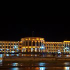
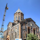

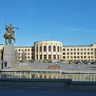
Our guide to Gyumri
Gyumri sightseeing
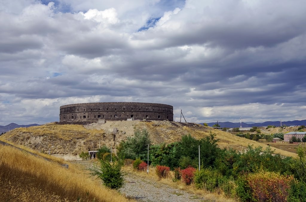
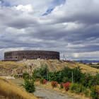
Black Fortress was built in 1837 right before the visit of Russian tsar Nikolai I. The fortress has a circular shape. The unusual black fortress was built on the highest hill in the area. It was an important protective facility during the Russian-Turkish war. Nowadays, there is no need to protect Gyumri from foreign invaders, and so the fortress is abandoned. This is a private estate that is slowly ruining now. … Open 