

 English
 Russian
 Dutch
Dutch German
 Spanish
 French
 Türkçe
Detailed hi-res maps of Nassau for download or print

City tours, excursions and tickets in Nassau and surroundings
Car rental on OrangeSmile.com

Search for services, infrastructure and sights on map of Nassau
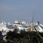
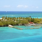
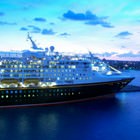
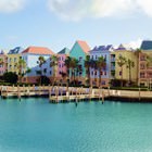
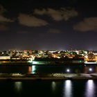
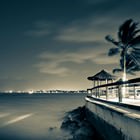
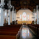
Photogallery of Nassau sightseeing

Our guide chapters over Nassau
Shopping, streets and outlets
Rum and Cuban cigars sold in many stores are more popular among men. It is still recommended to buy Tobacco products only in specialized store Cigar Stogies. Experts say that only here you can buy real hand-rolled Cuban cigars. For lovers of unusual creative souvenirs, they sell original handicrafts, one way or another related to Ernest Hemingway's works. The world-famous writer lived in the Bahamas for many years. … Open 
Advices for travellers
2. There is no public transport in Nassau, so you can walk on foot or use taxi services at the resort. The taxis are metered, so there is no need to worry about overpaying. 3. A car rental would be the best option for active tourists who are planning to travel a lot around the city. This service is available to persons over the age of 21 who have an international driving license. 4. Drivers should remember … Open
Nassau for children - what to visit
Nassau is famous for its natural attractions, and Ardastra Gardens, Zoo and Conservation Center is very popular among holidaymakers with children. This zoo is completely unlike the classic ones. It was opened on the territory of a picturesque nature reserve and its main inhabitants are birds. Dozens of bird species live here, including pink flamingos which take part in interesting shows. One of the main features of … Open
Travel guide to Nassau
In 1928, a water tower was built on the island, which is now considered one of its main attractions. Its height is about 40 meters, not so long ago a viewing platform was installed at the top of the tower. It is the highest observation deck in the Bahamas: in clear weather, from here you can see the famous island's sights and even other nearby islands. The Public Library building is of great architectural value … Open
Traditions and mentality of Nassau
Despite the fact that such events are quite widespread, only Nassau's Junkanoo is celebrated on such a grand scale that the holiday has become world-famous. In its scale and colorfulness, it is comparable to carnivals held in New Orleans and Rio de Janeiro. The festival opens and ends with colorful carnival processions participated by representatives of local folk groups, the city's best dancers, and ordinary … Open
Cuisine and top restaurants
At local restaurants, be sure to try lobster, in the preparation of which Bahamian chefs have reached incredible heights. Tortoise soup had been one of the local specialties for many years until it lost its former popularity in recent years. The number of turtles has decreased drastically and the reptile reached the verge of extinction. Such unfavorable changes inspired fans of high gastronomy to refuse cooking the … Open