

Country maps

Interactive maps of hiking and biking routes in Togo
1. You can zoom in/out using your mouse wheel, as well as move the map of Togo with your mouse.2. This interactive map presents two modes: 'Biking Routes' and 'Hiking Routes'. Use the '+' button on the map to switch between them.
Railway and landscape maps of Togo
This Togo map has two modes: 'Railway Network' and 'Landscape & Rural Map'. Use the '+' button on the map to navigate.Maps of cities and regions of Togo

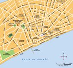
Lome
In West Africa, at the shore of the Gulf of Guinea, tourists can visit Lome, the capital and the largest city in Togo. This is a major industrial, administrative, and political center of the country. When planning a visit to this region, tourists need to keep in mind that there are two rainy seasons in Lome. The first one starts in April and ends in June, and the second rainy season lasts from September to November. Surprisingly, December is the hottest month in Lome, and August is the coldest. … Read more 