

Maps of cities and regions of Saint Lucia
Additional maps of Saint Lucia
Fantastic City Tours and Excursions in Saint Lucia
Country maps

Interactive maps of hiking and biking routes in Saint Lucia
1. You can zoom in/out using your mouse wheel, as well as move the map of Saint Lucia with your mouse.2. This interactive map presents two modes: 'Biking Routes' and 'Hiking Routes'. Use the '+' button on the map to switch between them.
Railway and landscape maps of Saint Lucia
This Saint Lucia map has two modes: 'Railway Network' and 'Landscape & Rural Map'. Use the '+' button on the map to navigate.Maps of cities and regions of Saint Lucia
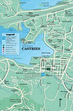
Castries
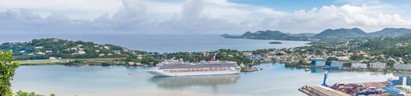
Not far from the Vigie peninsula, in the area of Port Castries Bay, tourists will find a charming beach resort named Castries. The city is situated in a naturally formed haven. The 20th century brought independence to this region and made Castries the capital of the Caribbean state of St. Lucia. Foreign tourists visit this place to see the pride of Castries with their own eyes – comfortable beaches located approximately two kilometers from the airport and very close to the city. The city … Read more 