

 English
 Russian
 Nederlands
 Deutsch
 Español
 Français
 Türkçe
Maps of Turks & Caicos Islands

Maps of cities and regions of Turks & Caicos Islands
Fantastic City Tours and Excursions in Turks & Caicos Islands
Car rental on OrangeSmile.com

Aura of Turks & Caicos Islands in photographs


Traditions in Turks & Caicos Islands

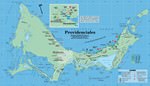
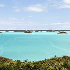
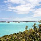
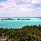
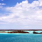
Providenciales Island
Providenciales Island was discovered in 1512 by Juan Ponce de León. He was a Spanish explorer and conquistador known for leading the first official European expedition to Florida and the first governor of Puerto Rico.No one lived here until this moment. Later, British colonists began to visit the island for the sake of salt and other valuable resources, and the entire archipelago received the status of a colony of Great Britain in 1766. In the future, the island of Providenciales was a part of … Read more 