

Printable maps of Novi Sad


Interactive maps of hiking and biking routes around Novi Sad
1. You can zoom in/out using your mouse wheel, as well as move the map of Novi Sad with your mouse.2. This interactive map presents two modes: 'Biking Routes' and 'Hiking Routes'. Use the '+' button on the map to switch between them.
Railway and landscape maps of Novi Sad area
This Novi Sad map has two modes: 'Railway Network' and 'Landscape & Rural Map'. Use the '+' button on the map to navigate.City tours, excursions and tickets in Novi Sad and surroundings
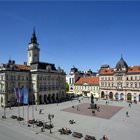
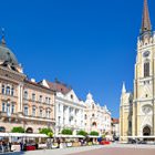
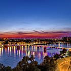
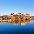
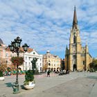
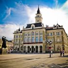
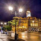
Photogallery of Novi Sad sights


Our guide to Novi Sad
Novi Sad sightseeing
The first settlement on the site of Novi Sad appeared yet in the 18th century. Orthodox Christian Serbians were the first settlers in the area. That was a period of religious tensions, so Orthodox Christians were not allowed to settle in the territory of Catholic Petrovaradin located on the other side of the Danube. In 1748, Empress Maria Theresa gave a name to a new Serbian settlement. She called it Neoplanta, a … Open 