

Interactive maps of hiking and biking routes around Herat
1. You can zoom in/out using your mouse wheel, as well as move the map of Herat with your mouse.2. This interactive map presents two modes: 'Biking Routes' and 'Hiking Routes'. Use the '+' button on the map to switch between them.
Railway and landscape maps of Herat area
This Herat map has two modes: 'Railway Network' and 'Landscape & Rural Map'. Use the '+' button on the map to navigate.City tours, excursions and tickets in Herat and surroundings
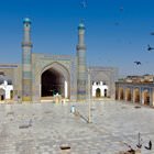
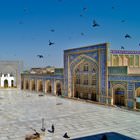
Photogallery of Herat sights

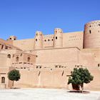
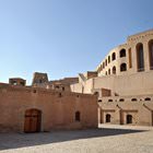
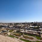
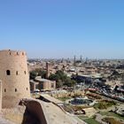
Our guide to Herat
Herat sightseeing
Herat has an airport with regular flights from Kabul, Kandahar, and Mashhad. If you decide to travel by bus, Mashhad is the best starting point. It will take approximately eight hours to reach the city. If you decide to travel in a car, you need to be very careful because the road to Herat can hide many challenges and problems because of an unstable situation in the country. … Open 