

Maps of cities and regions of Guatemala

Fantastic City Tours and Excursions in Guatemala
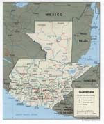
Country maps

Interactive maps of hiking and biking routes in Guatemala
1. You can zoom in/out using your mouse wheel, as well as move the map of Guatemala with your mouse.2. This interactive map presents two modes: 'Biking Routes' and 'Hiking Routes'. Use the '+' button on the map to switch between them.
Railway and landscape maps of Guatemala
This Guatemala map has two modes: 'Railway Network' and 'Landscape & Rural Map'. Use the '+' button on the map to navigate.Maps of cities and regions of Guatemala

Quetzaltenango
In southwestern Guatemala, tourists can visit a very interesting city named Quetzaltenango. As the official name is quite long, local people often call their home by its Mayan name – Xelaju or Xela. This region is very popular with tourists because of the hot springs and various handmade items made by local craftsmen. The city is not particularly rich in attractions. Despite this, foreign guests enjoy visiting Quetzaltenango to explore it and make a pleasant and useful journey to the nearby … Read more 

Guatemala City
The most visited tourist attraction of Guatemala is the Tikal National Park. It is one of the largest and most interesting cities in Mayan. On its territory, the majestic pyramids whose true purpose contemporaries can only guess, as well as the ruins of the sanctuaries, which were built almost 2,000 years ago was preserved. Almost the entire territory of the archaeological park is now accessible for visiting. During the tour, you can see its most hidden corners. In the vicinity of the city, … Read more