

Printable maps of Punta del Este


Interactive maps of hiking and biking routes around Punta del Este
1. You can zoom in/out using your mouse wheel, as well as move the map of Punta del Este with your mouse.2. This interactive map presents two modes: 'Biking Routes' and 'Hiking Routes'. Use the '+' button on the map to switch between them.
Railway and landscape maps of Punta del Este area
This Punta del Este map has two modes: 'Railway Network' and 'Landscape & Rural Map'. Use the '+' button on the map to navigate.City tours, excursions and tickets in Punta del Este and surroundings
Nature and parks of Uruguay
In Flores, vacationers can visit an unusual geological reserve, Palace Cave. Here, visitors will find several small sandstone caves, the age of which is more than 50 million years. The nearby museum offers many interesting artifacts, including a real dinosaur egg. The capital city also has areas where visitors can feel close to nature. For example, the Botanic garden is a favorite destination of all fans of bird watching, picnics, and refreshing shade of trees. Pleasant relaxation among exotic trees brought from different parts of the world is an excellent idea for a hot day in a big city. … OpenPhotogallery of Punta del Este sights


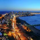

Our guide to Punta del Este
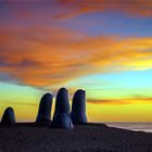
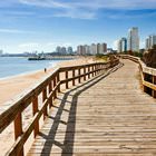
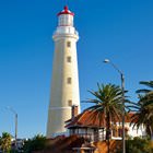
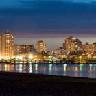
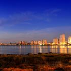
Punta del Este sightseeing
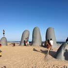
The first infrastructure in Punta del Este appeared yet in the 19th century thanks to the efforts of Francisco Aguilar. After the establishment of the settlement, the first ceramic factory in the region opened in Punta del Este. When Aguilar became the province’s governor, the first schools, churches, and administration buildings appeared in the city. Nowadays, all these buildings have become popular … Open 