

Interactive maps of hiking and biking routes around Port-au-Prince
1. You can zoom in/out using your mouse wheel, as well as move the map of Port-au-Prince with your mouse.2. This interactive map presents two modes: 'Biking Routes' and 'Hiking Routes'. Use the '+' button on the map to switch between them.
Railway and landscape maps of Port-au-Prince area
This Port-au-Prince map has two modes: 'Railway Network' and 'Landscape & Rural Map'. Use the '+' button on the map to navigate.City tours, excursions and tickets in Port-au-Prince and surroundings
Overview of festivals and celebrations in Haiti
The participants design and sew their costumes themselves. For men, a costume of a slave is the easiest to make – paper chains on the neck, arms, and legs and a waistcloth. The body is covered with a mix of coal power and oil. Women try to look eye-catching, which is not the way they dress in their everyday life, so they use cosmetics and bright fabrics. During the Lent, Haitians have one more carnival called Ra-Ra. This is the name of the Vodou priest who is considered the head of the carnival procession. This is the typical time for various rituals and folk dances and songs. Once again, drums are the main musical instrument. There are many festivals and carnivals in each Haitian town before Easter. … OpenPhotogallery of Port-au-Prince sights
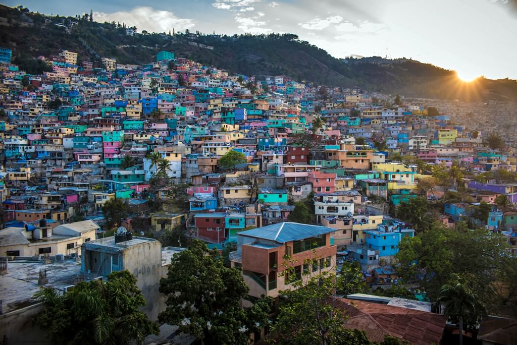

Our guide to Port-au-Prince
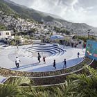
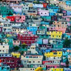
Port-au-Prince sightseeing
The Cathedral of Our Lady of the Assumption or simply the Port-au-Prince Cathedral is the main shrine in the capital. Originally, there was a wooden church on the site of the cathedral. Built in 1770, this church resembled a small warehouse. Its roof was covered with cement slate, and the bell was placed in the garret. As no one was taking care of the church, local authorities decided to close it. The old church … Open 