

Printable maps of Nurnberg


Interactive maps of hiking and biking routes around Nurnberg
1. You can zoom in/out using your mouse wheel, as well as move the map of Nurnberg with your mouse.2. This interactive map presents two modes: 'Biking Routes' and 'Hiking Routes'. Use the '+' button on the map to switch between them.
Railway and landscape maps of Nurnberg area
This Nurnberg map has two modes: 'Railway Network' and 'Landscape & Rural Map'. Use the '+' button on the map to navigate.City tours, excursions and tickets in Nurnberg and surroundings
Germany - moving around the country
 The development of the country's transport system is associated with progress of international and domestic trade relations. To the date, Germany's transport interchange is recognized as one of the best in the world. Therefore, there is always the best option for any tourist. Railways are very popular. They are laid both inside the city and between regions. This is worth considering when buying a ticket. In mountainous regions of the country, there are specially equipped cog railways, so you can have a train even to the ski resorts. The rail transport features the high comfort and punctuality. There is a subway in 10 major cities. In Berlin, there is the largest and most extensive subway network, which embraces a dozen lines and more than 170 stations.
… Open
The development of the country's transport system is associated with progress of international and domestic trade relations. To the date, Germany's transport interchange is recognized as one of the best in the world. Therefore, there is always the best option for any tourist. Railways are very popular. They are laid both inside the city and between regions. This is worth considering when buying a ticket. In mountainous regions of the country, there are specially equipped cog railways, so you can have a train even to the ski resorts. The rail transport features the high comfort and punctuality. There is a subway in 10 major cities. In Berlin, there is the largest and most extensive subway network, which embraces a dozen lines and more than 170 stations.
… Open Nature and parks of Germany
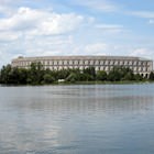
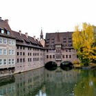
Germany has an incredibly picturesque landscape; there are 14 national and 95 natural parks. In the north of the country, you can find ice. Dense forests prevail in the central part; the Alps are located in the south. Several large rivers - the Rhine, the Danube, the Elbe - are found here. There are numerous lakes too, the largest of which is the Bodensee. The largest national park, Schleswig-Holstein Watts, is located in the north of the country, on the coast of the Wattee Sea and occupies more than 400 thousand hectares. The park is in the UNESCO World Heritage List. Almost 2/3 of lands is regularly flooded during high tides or are permanently under water. There are about 10 million different birds, 2 000 species of insects; common porpoises, gray seals and horsehead seals live in the waters off the coast of the Wattee Sea. … OpenPhotogallery of Nurnberg sights

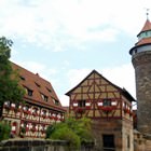
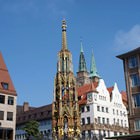
Our guide to Nurnberg
Active recreation
Nuremberg has several beautiful parks where it is always nice to walk. Even those who are not really fond of nature will enjoy themselves here. One of these is the well-kept Burgermeistergarten with its strikingly beautiful green landscapes and fragrant flowers. Take a chance to stroll through Stadtpark, the picturesque views of which are no less amazing. Want to spend time in silence away from the worldly fuss? … Open 
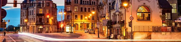
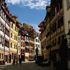
Weekend in Nurnberg in original style
Nuremberg's most popular attractions are Albrecht Dürer's House (Albrecht-Durer-Strabe) and a rabbit sculpture located nearby. A huge number of tourists come to see them every day. After admiring the outstanding sights, do not rush to leave the lively tourist area. At the exit from the square, look for a small restaurant that will be easy to distinguish from others by its peculiar interior. The restaurant’s … Open
Festivals and events in Nurnberg
The Toon Walk is rightly considered Nuremberg's most colorful event. This is a costume parade passing along the island within the city - Insel Schütt. Usually, it is held in early February, but sometimes in early November. People dress up as comic book heroes delighting city guests and locals with their bright costumes. The carnival even got into the Guinness Book of Records a few times: for a record number of hugs … Open
Advices for travellers
8. Public transport cruises the city till late evening, however late in the night one should better use taxi service to get to the desired destination. A taxi should be called by phone or taken from a specialized parking lot. The highest rates are charged by taxi drivers waiting for clients near hotels or restaurants. 7. Tourists who need to call to other countries should better use street call boxes … Open
Shopping, streets and outlets
The best place to choose some souvenirs is the "craft town" of Handwerkerhof. This is a long street with souvenir shops and workshops of various specializations. Here you can buy wonderful handmade tableware and home accessories, toys for children, and even real works of art. This craft town is also notable for the fact that several GREAT jewelry stores are located on its territory. Some of the most original … Open
Nurnberg for children - what to visit
Tucherland is aimed at vacationers with small children. This is a very beautiful entertainment center that is absolutely different from classic ones. Talented designers worked on its decoration, there are many playgrounds, inflatable attractions, trampolines, and swings for kids. You can even find a carousel in the center, and in the warmer months, some of the playgrounds and sports grounds are located outdoors. … Open