

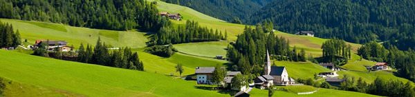
Printable maps of Interlaken


Interactive maps of hiking and biking routes around Interlaken
1. You can zoom in/out using your mouse wheel, as well as move the map of Interlaken with your mouse.2. This interactive map presents two modes: 'Biking Routes' and 'Hiking Routes'. Use the '+' button on the map to switch between them.
Railway and landscape maps of Interlaken area
This Interlaken map has two modes: 'Railway Network' and 'Landscape & Rural Map'. Use the '+' button on the map to navigate.City tours, excursions and tickets in Interlaken and surroundings
Switzerland - moving around the country
 Swiss Travel System operates in Switzerland. It enjoys an incredible popularity among tourists. Thanks to this system, you can buy tickets for any public transport in Switzerland, if the transport company works with this system. It’s possible to buy a ticket that serves for any transport, including airplane and ferry. In addition, with such a ticket you can visit some museums and historical places absolutely free of charge. When choosing a ticket, it is necessary to determine the future journey. The ideal option is to purchase a travel card for a month. Families can buy specific tickets, thanks to which children under 16 can use public transport for free. There is an opportunity to purchase a local ticket that will operate within a certain area. It will be much cheaper and more convenient, if you are not going to travel to different cities of Switzerland.
… Open
Swiss Travel System operates in Switzerland. It enjoys an incredible popularity among tourists. Thanks to this system, you can buy tickets for any public transport in Switzerland, if the transport company works with this system. It’s possible to buy a ticket that serves for any transport, including airplane and ferry. In addition, with such a ticket you can visit some museums and historical places absolutely free of charge. When choosing a ticket, it is necessary to determine the future journey. The ideal option is to purchase a travel card for a month. Families can buy specific tickets, thanks to which children under 16 can use public transport for free. There is an opportunity to purchase a local ticket that will operate within a certain area. It will be much cheaper and more convenient, if you are not going to travel to different cities of Switzerland.
… Open Nature and parks of Switzerland
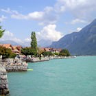
There are about 70 lakes on the territory of Switzerland, and all of them are of natural origin. The largest is Lake Geneva. It has a shape of a crescent moon. The southern part of it belongs to France. The region of Lake Geneva is often called the paradise on Earth. That's a very picturesque place combining mountain panoramas, alpine meadows, majestic ancient castles and, of course, a crystal clear water. Lake Constance is located on the border with Austria. There is a large number of different resorts, where sports competitions, festivals and other events take place. Reichenau Island is a UNESCO World Heritage Site. It houses a monastery built in the 8th century. … OpenPhotogallery of Interlaken sights

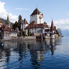
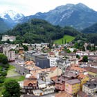
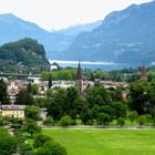
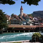
Our guide to Interlaken
Traditions and mentality of Interlaken
Gauklerfest, which is held at the end of July, always attracts numerous fans of street performances. Among the participants of the festival, there are always performers from different parts of the world. Numerous acrobats, musicians, jugglers, and comedians try to entertain the public and make sure no one is bored. One more interesting event, International Trucker & Country Festival, is held in the city at the end … Open 
Travel guide to Interlaken
In the immediate vicinity of Interlaken, there are beautiful St. Beatus caves, with which many interesting legends are associated. Locals believe that once in these caves lived dragons, which guarded these places from strangers. The present name of the complex caves is in honor of St. Beatus, a hermit who lived in the 6th century. He lived in these caves for many years, and his tomb was also discovered here. Today, … Open
Shopping, streets and outlets
Not far from the railway station is located EdelWeiss Gifts Shop, one of the best-known in the city. You can visit it with the whole family. Men will enjoy a huge number of Swiss knives, watches, flasks and other stylish men's accessories. Ladies can choose chic tablecloths and locally produced chocolate. A large section of the store is given for children's toys. The range of prices for goods is very wide. Unique … Open
Advices for travellers
2. Budget travelers should pay attention not only to local hotels, but also to camps that work throughout year. The most popular among them is called Alpenblick 2 and it is located on the shore of Lake Thun. The cost of accommodation in the camp will cost you just 6 francs a day. 3. Coop is a famous store that is popular not only with shoppers, but also with gourmets. In the morning hours the … Open
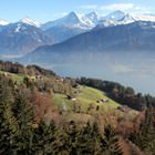
Active recreation
Vacationers wishing to burst their adrenaline level will find everything they want at local tourist offices that offer such activities as parachuting, rafting, and canyoning. A flight in a helicopter in a passenger’s seat also impresses many tourists. It is so easy to fall in love with Interlaken when seeing its fabulous panorama from above. For many vacationers, it will be also interesting to attend cooking … Open
Cuisine and top restaurants
Goldener Anker restaurant is a great family friendly place. Visitors with children will be provided with a special menu. During lunch time visitors will be offered a special menu with lunch dishes at most attractive prices. El Azteca restaurant specializes in cooking Mexican cuisine dishes. This dining facility has the full right to be called one of the most romantic dining facilities of Interlaken. In the evening … Open